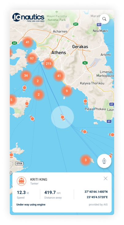
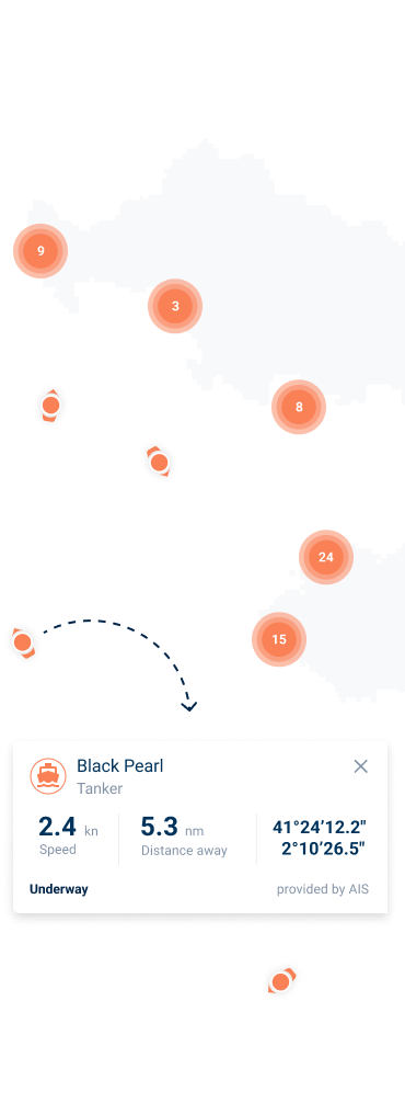
You can sea in the application marine traffic provided by terrestrial AIS in a very intuitive interface but it is more than that. Not all boats are equipped with AIS devices, meaning that the actual traffic we see is just a small glimpse of the real traffic on water.
Now this is changing!
When you use the application, your smartphone acts exactly like an AIS device installed on your
boat. It shows you as an anonymous boat on water. This way, we can really talk about real time traffic information,
making boating safer and easier for everyone.
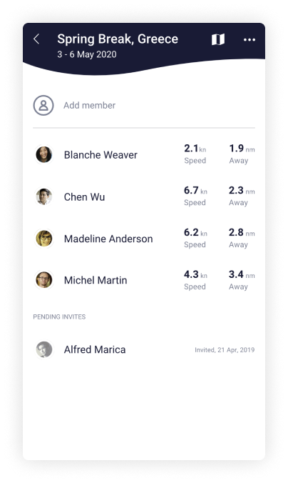
Flotilla Mode
Safe together! Easier planning!
Easily create a flotilla, invite other skippers to join it and you will be able to see each others stats.
Smartly enough these stats will be shown only while you are on water.
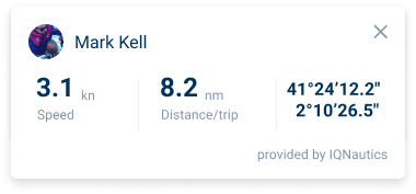
You can see the GPS coordinates of the other flotilla members, their speed and distance relative to you. Now you can easily provide assistance in case of need or better plan your arrivals.
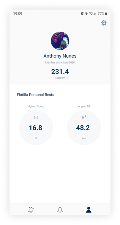
Are you the Lead Skipper to your flotilla? Now you can prove it.
The application smartly tracks your nautical miles, highest speed and longest leg. No worries, your app is smart enough to know when you are on water so it won’t track land activities. Now you will know how many nautical miles you covered on water during your flotilla trips.
Be the Alpha Skipper of our Community
Together we can make navigation safer and that is why we encourage you to use this application and share it with others. This is the power of the community put to good use! Especially in these times.
Yes, download the application, it works on iOS and Android, both smartphones and tablets. When opening, you will be able to create an account with social logins from facebook and google.
Flotilla mode is a feature for sharing live location with your fellow skippers. You can create a flotilla for a certain period of time and invite your friends, once they accept, you can see each other’s location.